Fishing Map Navigation & Features
Map Navigation (PC)
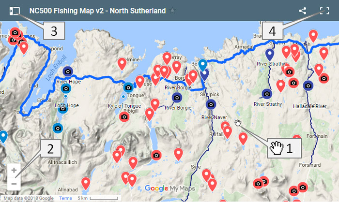
Each of the Fishing Area pages includes an embedded map which defaults to that approximate area. These are essentially just custom views of a single larger map covering the Northern Highlands.
|
1. To move around the map, hold the left mouse button down and move the hand cursor. |
|
|
|
|
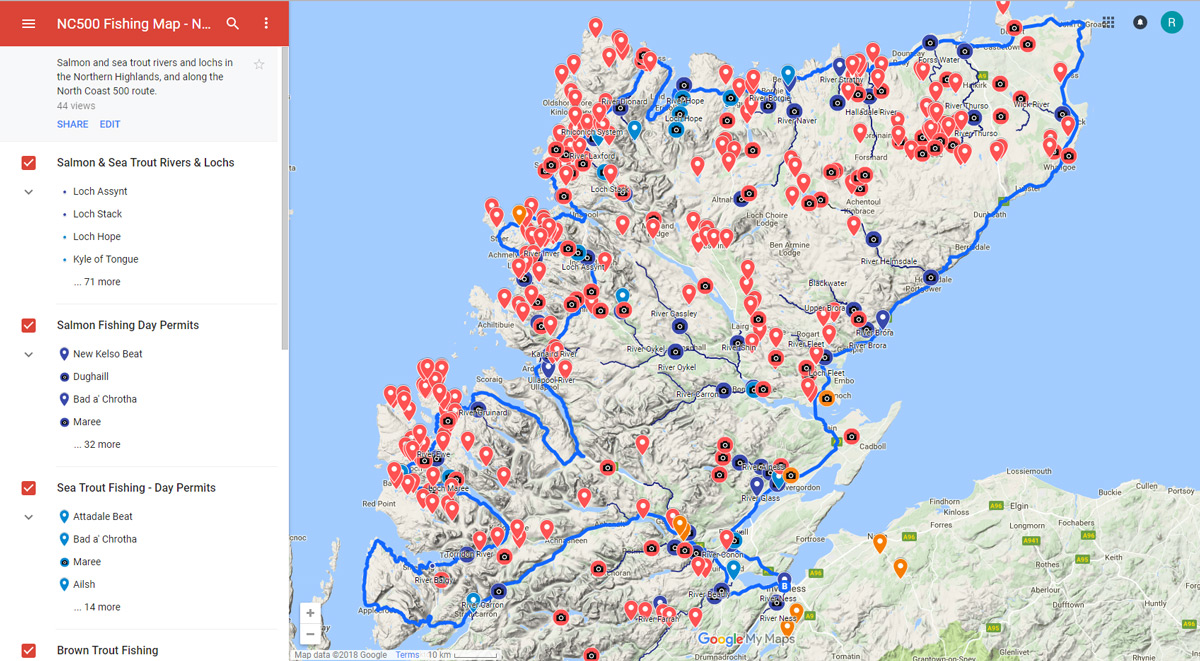
Map Layers
There are 10 different map layers that can be switched on/off that overlay the Google basemap (layer 0 here). For most visiting anglers the most useful of these will be the the top 4 layers, which hold all the location and database information for salmon, sea trout and brown trout fishing:
| Map Layer | Description | Example | |
| 10 | Salmon & Sea Trout Rivers & Lochs Dark blue |
The underlying base map does not show river systems well at all scales. This is intended to help show their location, but does not provide information on individual fisheries. |  |
| 9 | Salmon Fishing Day Permits Dark blue pins |
This layer shows the locations of rivers (and some lochs) where it is possible for visiting anglers to buy day permits to fish for salmon. Information is provided on where/how to buy permits if known. |  |
| 8 | Sea Trout Fishing - Day Permits Light blue pins |
This layer shows the locations of rivers and lochs where it is possible for visiting anglers to buy day permits to fish for sea trout. Information is provided where known, on where to buy permits, with links to further info. |  |
| 7 | Brown Trout Fishing Red pins |
This layer shows the locations of over 300 waters, mainly lochs, that hold wild brown trout. Information is provided on where to buy permits where known, with links to further information. |  |
| 6 | Stocked Trout Fisheries Orange pins |
There are several stocked rainbow trout fisheries in the region; most in Easter Ross and the Inverness area. |  |
| 5 | Coarse Fishing Green pins |
This layer shows the location of rivers and lochs which hold coarse fish; essentially pike and perch. The Conon system is the most northerly, east coast river system to hold pike. |  |
| 4 | Sea Fishing Purple pins |
Currently this layer shows some basic information on sea fishing boat charters. |  |
| 3 | Fishing Services | This layer shows fishing tackle outlets, locations of permit providers and fishing guides. Some of the fishing services listed may be sponsored. |  |
| 2 | Other Services | This layer is reserved for advertisers offering other services such as accommodation. |  |
| 1 | North Coast 500 Route | This is the official North Coast 500 route. |  |
| 0 | Base Map | This is the bottom map layer, visible at all times. There are several options including satellite imagery, which can be useful, but the default view is the topographic map. |  |
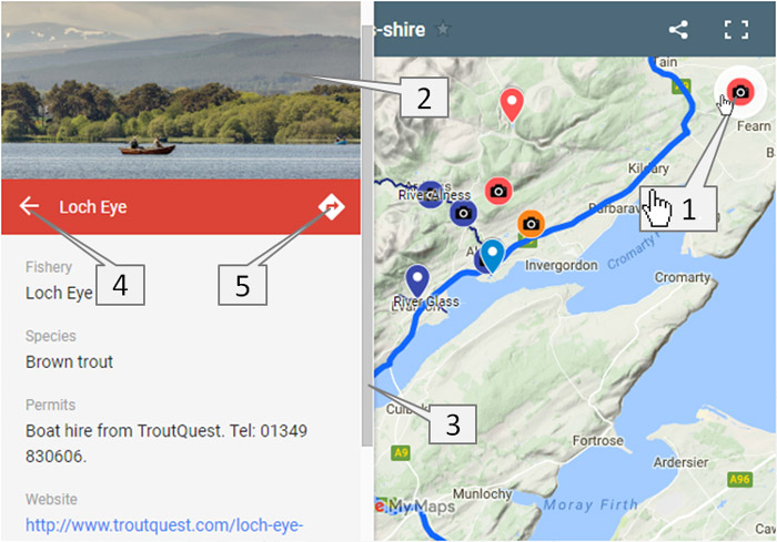
Pin Data
If you select any map pin (1.) in the embedded or full screen map a linked data panel will slide in from the left hand side.
|
2. If there is a photo associated with the pin it will display here. NB: the photo will be of the loch/river featured, but may not have been taken at the precise location of the pin. |
|